On
August 11, the two-day 2022 China Geographic Information Industry Conference
kicked off at Hefei Binhu International Convention and Exhibition Center. As a
national high-tech enterprise specializing in the research and development,
design, production and sales of high-end intelligent equipment such as UAVs,
United Aircraft launched the intelligent unmanned flight solution for the
geographic information industry during the conference, fully empowering
high-definition surveying and mapping, aerial geophysical exploration, surface resource
identification, meteorological detection, high-resolution radar imaging, 3D
model data acquisition, 3D modeling of oblique photography, etc. A variety of
large-scale unmanned helicopters, multi-rotor small UAVs, and a new generation
of autonomous and controllable military-civilian dual-purpose 2D and 3D
integrated geographic information application platform developed by United
Aircraft were showcased. The booth attracted a large number of visitors to stop
for consultation, exchange, and discussion.
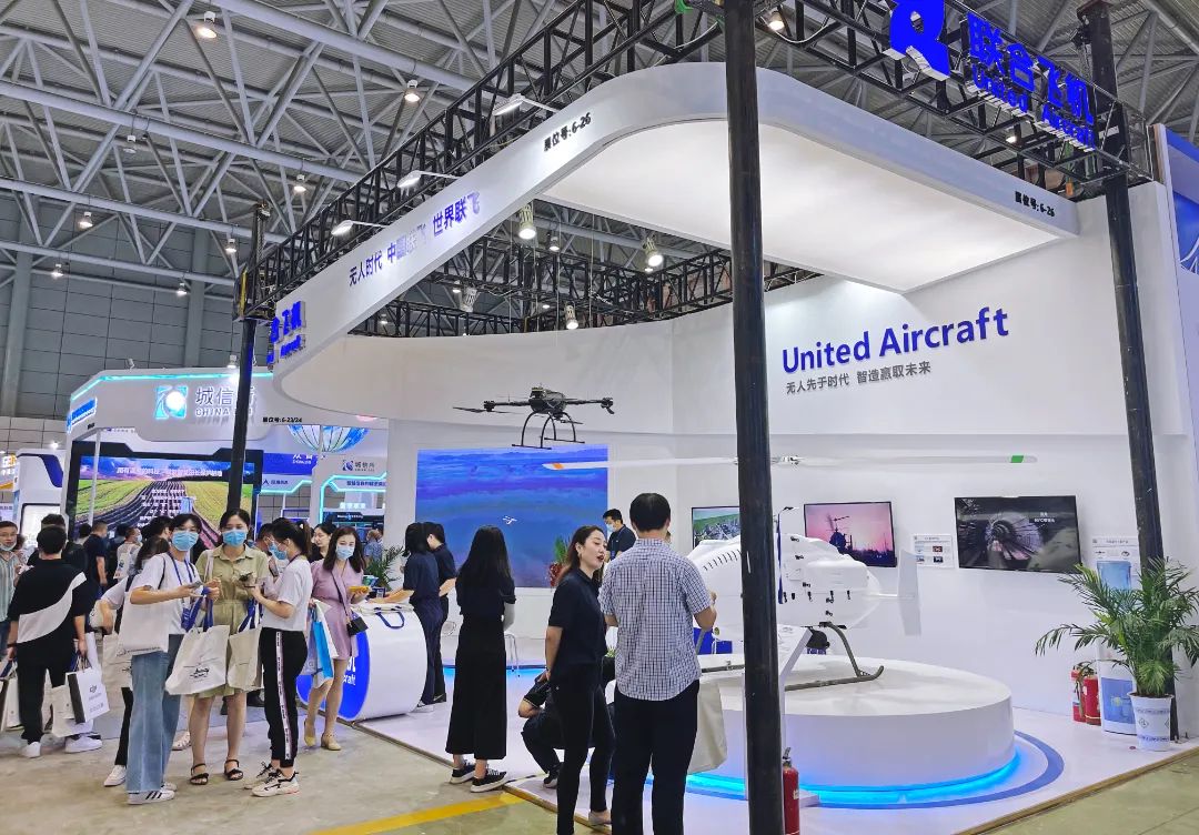
United Aircraft Booth
The multi-integrated data collection unmanned flight
solution provided by United Aircraft enables the high-quality development of
the land and information industry. In view of the actual geographical features
of China's vast territory and complex terrain, the current geographic
information data collection generally has many pain points such as long
collection period, high cost, weak wind resistance, unsustainable operation in
extreme environments, and single data collection. The unmanned helicopter
launched by United Aircraft has a maximum payload of 120kg. Professional
surveying and mapping can carry seven kinds of professional equipment at one
time, realizing multi-function of one machine. It has high-definition surveying
and mapping, identification of surface resources, weather detection,
high-resolution radar imaging, and oblique photography. Modeling and fusion
processing data and other functions; moreover, the unmanned helicopters of
United Aircraft also have the characteristics of long cruise distance, long
battery life, fast speed, etc., which can realize geological surveying and
other operations in a wider territory; United Aircraft also innovatively proposed
a high-precision ultra-steady-state flight control technology solution to endow
the unmanned helicopter with high wind resistance and stability, allowing it to
operate under 12 m/s wind disturbance conditions and to meet requirements for diversified
operations under special terrain conditions. The use of unmanned helicopters
does not depend on runways and they can take off and land vertically and in
different places, realizing the function of hovering operation, and are
applicable to the diversified and complex application scenarios in the
geographic information industry for accurate operations; it is worth mentioning
that the United Aircraft's unmanned helicopters are inherently equipped with
airborne processing software so as to reduce tasks in the future, compressing
the previous 10 days of tasks into one day. Together with a variety of
equipment, the operation efficiency can be increased by 10-50 times.
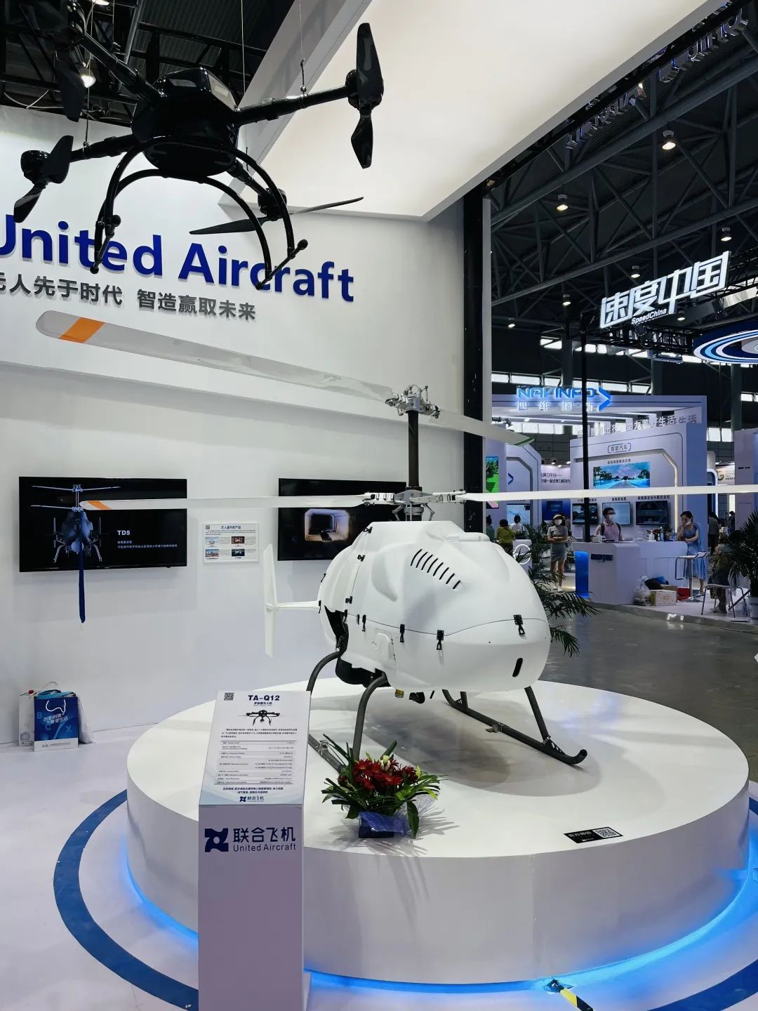
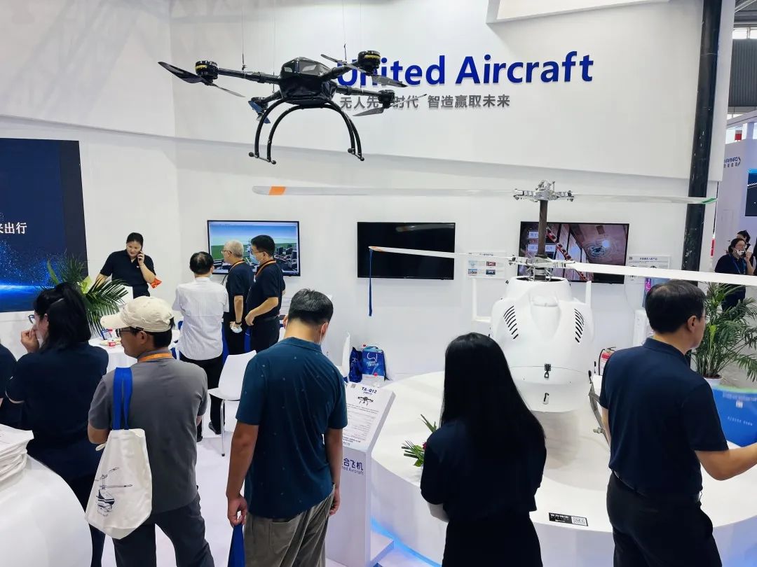
United Aircraft's two products on display
At the conference, United Aircraft launched the
TD220-350kg coaxial unmanned helicopter and the TA-Q12 multi-rotor small UAV. Furthermore,
it also showcased airborne and ground equipment, composite products, and rotor
systems through the multimedia platform, systematically displayed new equipment
and customized solution capabilities, and demonstrated a series of high-end
products and technologies of United Aircraft, attracting national news, finance
and economics. science and technology media to report.
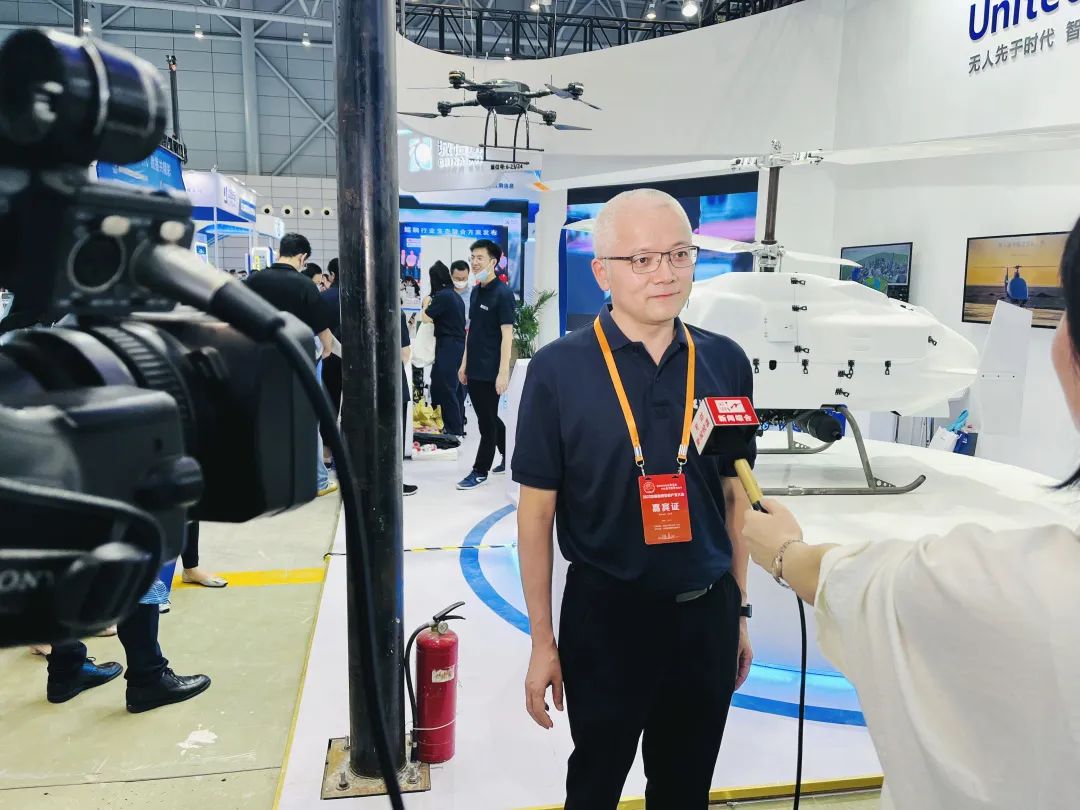
Tian Gangyin, Chairman and President of United Aircraft
Group, was interviewed by the media
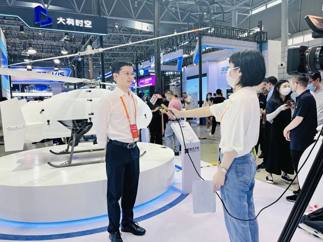
Wang Kanghong, Executive Vice President of United
Aircraft Group, was interviewed by the media
How to enable the integrated development of the geographic
information industry: The three keynote speeches vividly demonstrated the fact
that United Aircraft boosts the geographic information industry from era 1.0 of
manned surveying and mapping, era 2.0 of small drone surveying and mapping, and
era 3.0 of great-load UAV surveying and mapping. In a foreseeable future,
surveying and mapping will be an integrated mode of space, sky, and ground to
achieve global information collection. The speeches were splendid, attracting
many professionals to listen, ask and answer, and participate in the
discussion.
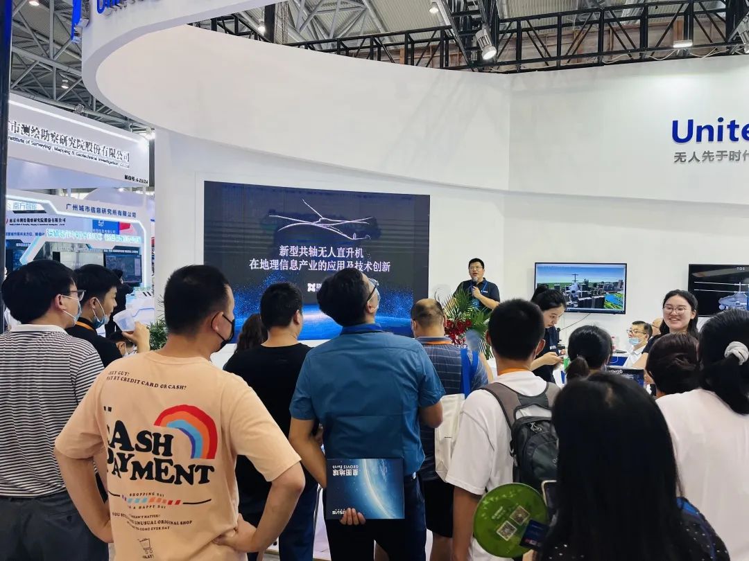
Keynote
Speech
The TD220 coaxial unmanned helicopter that attracted much
attention at the booth was the only UAV in China that participated in the
celebration of the 40th anniversary of reform and opening up. It is
characterized by high degree of automation, safety and reliability, and strong
mission expansibility. It is currently a leading small unmanned helicopter with
great load capacity, long flight time, high ceiling, small size, and strong
environmental adaptability. This model can be used in fields such as aerial
surveying and mapping, aerial geophysical exploration, minefield detection, and
communication relay.
TD220共轴无人直升机
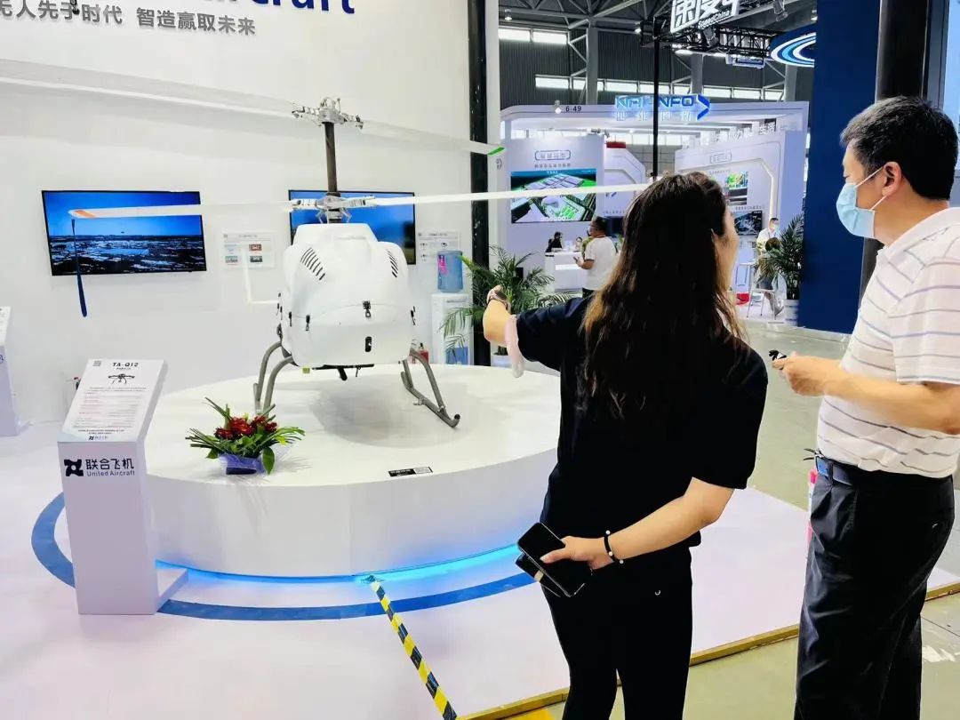
TD220 Coaxial Unmanned Helicopter
TD220 Coaxial Unmanned Helicopter

United Aircraft's Booth Attracted Many Industry Insiders
Another small quad-rotor UAV, TA-Q12, also harvested a
large wave of traffic on site. This model is made of carbon fiber in one piece,
adopts advanced algorithms such as active disturbance rejection, and has a
stable flight attitude, which is suitable for a variety of complex working
conditions. It can realize the centimeter-level UAV positioning and carry
visible light/infrared/laser ranging three-light EO pod, which can truly
achieve high-precision positioning of targets and real-time transmission of
target images. This product can perform tasks such as surveying and mapping,
reconnaissance, patrol, SAR, etc. It has the advantages of fast deployment
time, long operating distance, long flight time, and simple maintenance.
TA-Q12 Quad-Rotor UAV

United Aircraft Booth Staff Welcome Visitors
In addition to the product exhibition, United Aircraft
also displayed a new generation of self-controllable military-civilian dual-purpose
2D and 3D integrated geographic information application platform that features
efficient, fast, and easy integration, stable operation, platform-crossing
performance, aesthetic and simple appearance and expansibility in order to
provide overall UAV geographic information collection solutions for military
and civilian industries. The engineer demonstrated the UAV path dynamic
planning and real-time dynamic obstacle avoidance functions on the spot, which
attracted many onlookers eager to try it out.
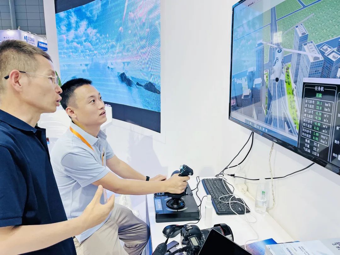
A new generation of autonomous and controllable military-civilian dual-purpose 2D and 3D integrated geographic information application platform
United Aircraft
As the seventh director unit of China Association for Geospatial
Industry and Sciences, United Aircraft was honored as the executive director
unit at the second council of the seventh session held by the Association on
August 10th. In the future, United Aircraft will further exert its advantages
in technology research and development, product application, market experience,
etc., while fulfilling the responsibilities of the executive director unit to actively
integrate into the development wave of the geographic information industry and
explore new applications and new models of UAVs in geographic information
industry in order to boost the "UAV + geographic information"
high-quality, intelligent, and innovative development.